Study scope
The purpose of this mapper is to allow easy access to results of two studies on trends in streamflow. These studies describe how low and high flows in the Nation's streams
and rivers have changed over time.
Dudley, R.W., R.M. Hirsch, S.A. Archfield, A.G. Blum, and B. Renard (2020)
Low streamflow trends at human-impacted and reference basins in the United States,
Journal of Hydrology, 580, 124254, https://doi.org/10.1016/j.jhydrol.2019.124254.
Hodgkins, G.A., R.W. Dudley, S.A. Archfield, B. Renard (2019)
Effects of climate, regulation, and urbanization on historical flood trends in the United States,
Journal of Hydrology, 573, 697-709, https://doi.org/10.1016/j.jhydrol.2019.03.102.
The Nation's rivers and streams are a valuable resource, providing drinking water, irrigation, habitat, and recreational opportunities.
Low streamflows play a an important role in water management for wastewater discharge and water withdrawals, informing operating policies for low-streamflow releases from dams.
Floods may cause fatalities, and damage property and transportation infrastructure.
In order to more effectively manage and protect the Nation's people, water resources, aquatic ecosystems, and transportation infrastructure in the future we need to know how and why low flows, mean flows, and high flows, have been changing over time.
The U.S. Geological Survey (USGS) in cooperation with the Environmental Protection Agency (EPA) and Federal Highways Administration
conducted this work using streamflow data which was collected by the USGS.
Publicly available streamflow data for streams and rivers were obtained from the U.S. Geological Survey's National Water Information System (NWIS) database here.
Publicly available gage characteristics were obtained from the Geospatial Attributes of Gages for Evaluating Streamflow, version II, (GAGES-II) database: Falcone, J.A., 2011, GAGES-II—Geospatial attributes of gages for evaluating streamflow: U.S. Geological Survey metadata, also available here.
Note that this dataset includes both regulated and unregulated rivers and streams. Regulation by upstream dams or other human modifications to streamflow can have a sizeable impact on downstream flow, resulting in trends in the streamflow record. This mapping tool does not provide information on upstream conditionsupstream conditions, so additional investigation of individual streamgages may be needed before drawing conclusions.
Low-flow analyses were computed based on climatic years which run from
April 1 through March 31 of the ensuing calendar year and were named for the year in which it ends.
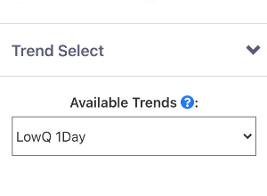
- LowQ 1Day, LowQ 3Day, LowQ 7Day: Lowest annual 1-, 3-, and 7-day average streamflow, respectively.
- Scaled Deficit: Daily deficits were first computed as the difference between the daily mean streamflow having the probability of not being exceeded 2-percent of the time over the period of record (Q2) threshold and
daily mean streamflows equal to or lower than Q2; those differences were then divided by the Q2 value to yield scaled deficits. The Q2 annual deficit is computed as the mean of all daily scaled deficits for all days
when daily mean streamflows were equal to or lower than the Q2. (dimensionless)
- Q2 nDays: Number of annual days the daily mean streamflow value was less than or equal to the Q2.
- First Julian date flow <= the Q2 threshold: First annual Julian date when the daily mean streamflow value was less than or equal to Q2
- Last Julian date flow <= the Q2 threshold: Last annual Julian date when the daily mean streamflow value was less than or equal to Q2
- JD Difference Q2: Difference between the last and first annual Julian date when the daily mean streamflow value was less than or equal to Q2
- ZeroQ nDays: Number of annual zero-flow days
Mean annual flows were computed on the basis of climatic year which occurs from April 1 through March 31 and named for the year in which it ends.
- Mean Annual Q: Mean annual streamflow
High-flow analyses were computed on the basis of water year which occur from October 1 through September 30 and named for the year in which it ends.
- Annual peak streamflow: The highest streamflow during the year
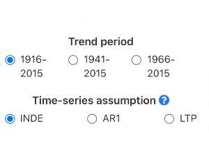
The significance of trends over time are sensitive to assumptions regarding whether
the time-series data are independent, exhibit short-term persistence, or have
long-term persistence. Trend significance is reported for three different
null hypotheses of the serial structure of the time-series data: independence
(INDE), short-term persistence (AR1), and long-term persistence (LTP).
For instance, a trend may be statistically significant (p < 0.05) when assuming an
"independent" null hypothesis but might not be significant when a null LTP hypothesis
is considered instead. For more information see: Hamed, K.H., 2008, Trend detection in hydrologic data:
The Mann-Kendall trend test under the scaling hypothesis, Journal of Hydrology,
349: 350-363; Hamed, K.H., and Rao, R., 1998, A modified Mann-Kendall
trend test for autocorrelated data, Journal of Hydrology, 204: 182-196; and Cohn, T.A., Lins, H.F., 2005,
Nature’s style - Naturally trendy: Geophysical Research Letters, doi.org/10.1029/2005GL024476.
A trend is significant if the trend-test yields a p-value
less than or equal to 0.05 for the given null hypothesis of the serial
structure of the time-series data (INDE, AR1, LTP; see previous question).
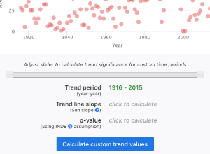
Tests for trend significance were computed using the Mann-Kendall test that included methods that considered the possibility of short- and long-term persistence in the time-series data. The magnitude of monotonic trends were computed using the Sen slope which is the median of all pairwise slopes. A positive magnitude is an upward trend (increase over time), a negative magnitude is a downward trend (decrease over time), and a magnitude of zero indicates no trend.
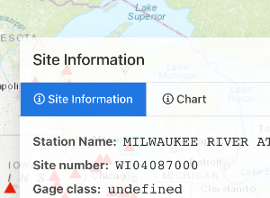
The trends from the two studies used 3 periods: 1916-2015, 1941-2015 and 1966-2015. Clicking on a streamgage will allow you to customize the trend period using the INDE assumption.
Features of The Mapper
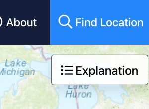
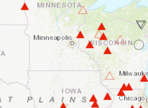
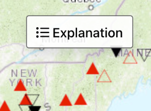
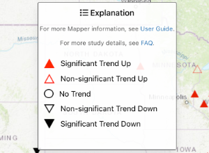
An explanation of the arrows and icons on the map and what they mean can be found in the User Guide Explanation tab.
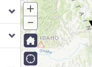
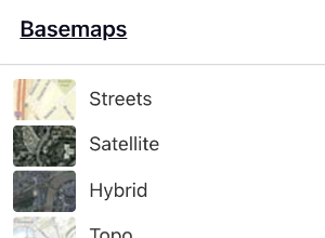
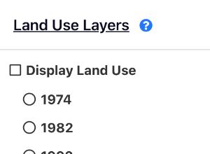
A description of how to activate map layers can be found in the User Guide Map Select Options tab.
A description of the search and zoom capabilities can be found in the User Guide Search and Zoom tab.
Yes. All daily streamflow data and instantaneous peak streamflow data are publicly available and can be downloaded from the U.S. Geological Survey's National Water Information System (NWIS) database here. Additional information on the data preparation and screening processes is available in the two papers referenced in FAQ #1.
Streamgage characteristics and trend results can be downloaded from the following USGS Data Releases:
- Dudley, R.W., Hirsch, R.M., Archfield, S.A., Blum, A.G., and Renard, B., 2019, Low-streamflow trends and basin characteristics for 2,482
U.S. Geological Survey streamgages in the conterminous U.S. (ver. 2.0, February 2019): U.S. Geological Survey data release,
https://doi.org/10.5066/P9LO24MG.
- Dudley, R.W., Archfield, S.A., Hodgkins, G.A., Renard, B., and Ryberg, K.R., 2018,
Peak-streamflow trends and change-points and basin characteristics for 2,683 U.S. Geological Survey streamgages in the conterminous U.S.
(ver. 3.0, April 2019): U.S. Geological Survey data release, https://doi.org/10.5066/P9AEGXY0.
Study methods
The magnitudes of monotonic trends were computed using the Sen slope, a nonparametric approach.
- Sen, P.K., 1968. Estimates of the regression coefficient based on Kendall's tau. J. Am. Stat. Assoc. 63, 1379-1389
The significance of monotonic trends was computed using the nonparametric Mann-Kendall test including variations that considered the possibility of short- and long-term persistence in the time-series data. Note that in rare cases, a time series may have a significant trend result while the computed magnitude of the trend is zero due do the presence of many ties in the pairwise slope computations (e.g. sites with many years of zero flow).
R-code for our general Mann-Kendall test can be downloaded from either of the following data releases:
- Dudley, R.W., Hirsch, R.M., Archfield, S.A., Blum, A.G., and Renard, B., 2019, Low-streamflow trends and basin characteristics for 2,482 U.S. Geological Survey streamgages in the conterminous U.S. (ver. 2.0, February 2019): U.S. Geological Survey data release https://doi.org/10.5066/P9LO24MG
- Dudley, R.W., Archfield, S.A., Hodgkins, G.A., Renard, B., and Ryberg, K.R., 2018, Peak-streamflow trends and change-points and basin characteristics for 2,683 U.S. Geological Survey streamgages in the conterminous U.S. (ver. 2.0, October 2018): U.S. Geological Survey data release https://doi.org/10.5066/P9AEGXY0
Candidate sites were considered from among the 9,062 gages in the Geospatial Attributes of Gages for Evaluating Streamflow,
version II, (GAGES-II) database: Falcone, J.A., 2011, GAGES-II—Geospatial attributes of gages for evaluating streamflow:
U.S. Geological Survey metadata, also available
here.
Data downloaded from the USGS National Water Information System (NWIS) for all candidate gages were then subjected to length and completeness criteria.
Study gages were required to have complete data for at least 8 out of every 10 years for each decade (e.g. 1990-1999) in the time periods tested. Further detail on the data preparation is available in the two papers references in FAQ#1. Also noted in FAQ #4, the selected streamgages include a range of conditions in terms of upstream land use, regulation, and withdrawals.
Citations
All of the results in the mapper are reported in these USGS Data Releases:
Dudley, R.W., Hirsch, R.M., Archfield, S.A., Blum, A.G., and Renard, B., 2019,
Low-streamflow trends and basin characteristics for 2,482 U.S. Geological Survey
streamgages in the conterminous U.S. (ver. 2.0, February 2019): U.S. Geological Survey
data release,
https://doi.org/10.5066/P9LO24MG
Dudley, R.W., Archfield, S.A., Hodgkins, G.A., Renard, B., and Ryberg, K.R., 2018,
Peak-streamflow trends and change-points and basin characteristics for 2,683 U.S. Geological
Survey streamgages in the conterminous U.S. (ver. 2.0, October 2018): U.S. Geological Survey
data release,
https://doi.org/10.5066/P9AEGXY0
For questions related to the operation of the Trend Mapper, you can contact:
Hans Vraga
Project Manager, Web Informatics and Mapping (WIM)
Email:
hvraga@usgs.gov